How to use drone deploy – How to use DroneDeploy? It’s easier than you think! This guide walks you through everything from setting up your account and planning your flight to processing data and creating stunning deliverables. We’ll cover the different subscription plans, best practices for safe drone operation, and troubleshooting tips to help you get the most out of your DroneDeploy experience. Whether you’re a beginner or an experienced drone pilot, you’ll find valuable insights here.
We’ll delve into the specifics of flight planning, including crucial considerations like altitude, overlap, and camera settings. You’ll learn how to navigate airspace regulations, connect your drone, and address common connectivity problems. We’ll also show you how to process your drone imagery, generate various deliverables like orthomosaics and 3D models, and explore the advanced features and integrations DroneDeploy offers.
Get ready to unlock the power of drone mapping!
Getting Started with DroneDeploy
DroneDeploy simplifies drone data capture and analysis. This section covers account creation, app installation, and understanding subscription plans.
DroneDeploy Subscription Plans
DroneDeploy offers various subscription plans catering to different needs and budgets. These plans typically include features like flight planning, data processing, and storage capacity. Basic plans might offer limited features and storage, while enterprise plans provide extensive capabilities and support. Check the DroneDeploy website for the most up-to-date pricing and features for each plan. Consider your project scope, data volume, and required features when selecting a plan.
Creating a DroneDeploy Account
- Visit the DroneDeploy website and click on “Sign Up”.
- Provide your email address and create a strong password.
- Complete any necessary registration forms, providing information such as your name and organization.
- Check your email inbox for a verification link sent by DroneDeploy. Click the link to verify your email address and activate your account.
Downloading and Installing the DroneDeploy Mobile App
- Open the app store on your mobile device (App Store for iOS or Google Play Store for Android).
- Search for “DroneDeploy”.
- Select the official DroneDeploy app and tap “Install”.
- Once installed, open the app and log in using your newly created account credentials.
Planning Your Drone Flight: How To Use Drone Deploy
Careful flight planning is crucial for successful drone operations. This section details designing a flight plan, pre-flight checklists, and understanding airspace regulations.
Designing a DroneDeploy Flight Plan
The DroneDeploy software allows you to create detailed flight plans. You’ll define the area to be mapped, setting parameters like altitude, overlap (both front and side), and camera settings (e.g., resolution, image format). Higher altitude generally covers a larger area but reduces image detail. Sufficient overlap (typically 70-80% front and side) is needed for accurate image stitching during processing.
The camera settings influence the image resolution and file size.
Pre-Flight Checklist Best Practices

- Check battery levels and ensure sufficient charge for the planned flight time.
- Inspect the drone for any physical damage or loose components.
- Verify GPS signal strength and accuracy.
- Review the planned flight path and ensure it’s safe and legal.
- Check weather conditions and postpone the flight if necessary (high winds, rain, etc.).
Understanding Local Airspace Regulations
Before flying, familiarize yourself with local airspace regulations, including no-fly zones and required permits. Websites like FAA DroneZone (for the US) or similar national aviation authorities provide resources to check airspace restrictions and obtain necessary permissions.
Executing the Drone Flight

This section covers connecting your drone, initiating a flight, and troubleshooting connectivity issues.
Connecting Your Drone and Initiating a Flight
- Ensure your drone is powered on and connected to your mobile device via Wi-Fi or other supported connection.
- Open the DroneDeploy app and select your flight plan.
- Follow the app’s instructions to initiate the automated flight. The app will guide you through the takeoff, flight, and landing procedures.
- Monitor the flight progress on the app.
Troubleshooting Connectivity Issues
Connectivity problems can occur due to various factors. Check your drone’s Wi-Fi signal strength, ensure your mobile device has a strong cellular or Wi-Fi connection, and make sure there are no obstructions interfering with the signal. If problems persist, restart both your drone and mobile device, and check for software updates.
Drone Model Flight Parameter Comparison
| Drone Model | Altitude (m) | Speed (m/s) | Camera Settings (Example) |
|---|---|---|---|
| DJI Mavic 3 | 50-100 | 5-10 | 20MP, JPEG/RAW |
| DJI Phantom 4 RTK | 50-150 | 5-15 | 20MP, TIFF |
| Autel EVO II | 40-80 | 3-8 | 48MP, JPEG/RAW |
| (Add more models as needed) |
Processing and Analyzing Data
This section details uploading, processing, and troubleshooting imagery within the DroneDeploy platform.
Uploading and Processing Drone Imagery
- Once the flight is complete, the DroneDeploy app will automatically upload the captured imagery to the cloud.
- DroneDeploy will then process the images using its sophisticated algorithms, creating orthomosaics, 3D models, and point clouds.
- Monitor the processing progress within the DroneDeploy platform.
Processing Options and Their Impact
DroneDeploy offers different processing options, such as resolution, orthorectification methods, and point cloud density. Higher resolution processing results in more detailed deliverables but requires more processing time and storage. The choice depends on the project requirements and the desired level of detail.
Common Image Processing Errors and Solutions
- Insufficient Overlap: Increase the overlap percentage in your flight plan.
- Poor Image Quality: Check camera settings, lighting conditions, and ensure the drone is stable during flight.
- Processing Errors: Check the DroneDeploy logs for error messages and contact support if needed.
Creating Deliverables
This section covers generating various deliverables from the processed data and their applications.
Generating Deliverables (Orthomosaics, 3D Models, Point Clouds)
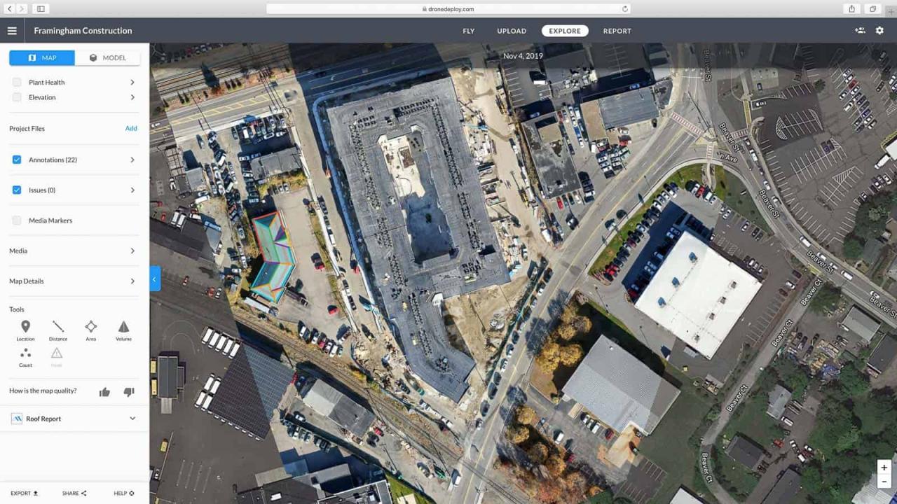
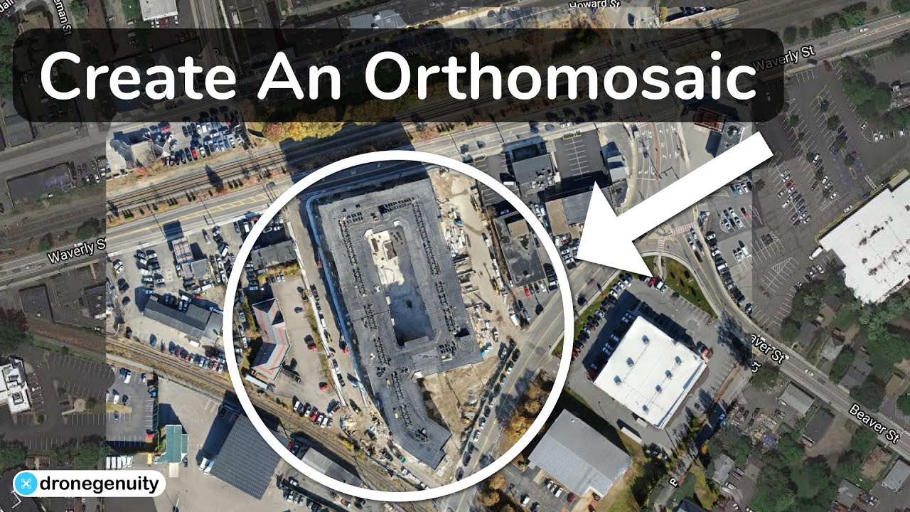
After processing, you can generate various deliverables directly within the DroneDeploy platform. Orthomosaics are georeferenced 2D maps; 3D models provide a three-dimensional representation of the area; point clouds contain millions of individual 3D points representing the terrain surface.
Applications Across Industries
DroneDeploy deliverables are used in various sectors, including construction (site monitoring, progress tracking), agriculture (crop health assessment, yield prediction), mining (volume calculations, site surveying), and insurance (damage assessment).
Exporting Data in Different Formats
DroneDeploy allows exporting data in various formats, including GeoTIFF (for georeferenced images), KML (for Google Earth), and PDF (for reports).
Advanced Features and Integrations
This section explores advanced DroneDeploy features and integrations with other software.
Advanced Features (Automated Flight Planning, Data Analytics Tools)
DroneDeploy offers advanced features like automated flight planning, which optimizes flight paths for efficient data acquisition. Data analytics tools allow extracting measurements, calculating volumes, and identifying areas of interest directly within the platform.
Integration Capabilities
DroneDeploy integrates with other software platforms, such as GIS systems (ArcGIS, QGIS) and cloud storage services (Dropbox, Google Drive), streamlining workflows.
Comparison with Other Drone Mapping Software
DroneDeploy competes with other drone mapping software solutions. The choice depends on specific needs, budget, and preferred features. Factors to consider include ease of use, processing speed, data accuracy, and integration capabilities.
Troubleshooting and Support
This section provides solutions to common problems and guidance on seeking technical support.
Common Problems and Solutions
- Flight Errors: Check for GPS signal strength, battery level, and obstructions.
- Processing Failures: Review the processing logs and contact support if necessary.
- Data Export Issues: Ensure you have the necessary permissions and check the export settings.
Technical Support Channels, How to use drone deploy
DroneDeploy offers various support channels, including email support, online documentation, and a community forum. Check their website for contact details and support resources.
Reporting Bugs or Issues
- Gather relevant information, including screenshots, error messages, and steps to reproduce the issue.
- Access DroneDeploy’s support portal or contact their support team directly.
- Clearly describe the problem and provide all relevant information.
Illustrative Examples
This section provides real-world examples of DroneDeploy applications.
Construction Site Monitoring
A construction company used DroneDeploy to monitor the progress of a large-scale building project. They used a DJI Phantom 4 RTK drone to capture high-resolution imagery. The generated orthomosaics and 3D models allowed them to track progress, identify potential issues, and ensure the project stayed on schedule. Challenges included managing large data sets and ensuring accurate georeferencing.
The project highlighted the efficiency gains of using drone-based data capture and analysis for construction management.
Getting started with drone mapping? First, you’ll need a solid plan. Then, check out this awesome resource on how to use DroneDeploy to learn the software’s ins and outs. Understanding the flight planning tools and data processing within DroneDeploy is key to getting high-quality results from your drone missions. Mastering how to use DroneDeploy will significantly improve your workflow.
Agricultural Applications

A farmer used DroneDeploy to monitor the health of their crops. Using a DJI Mavic 3, they captured imagery of their fields. Data processing revealed areas with nutrient deficiencies or disease. This allowed for targeted interventions, optimizing fertilizer and pesticide application, ultimately improving crop yields. The precision provided by DroneDeploy’s data analysis resulted in a significant reduction in resource waste and increased profitability.
Mastering DroneDeploy opens up a world of possibilities for efficient data collection and analysis. From construction site monitoring to precision agriculture, the applications are vast. By following the steps Artikeld in this guide, you’ll be well-equipped to plan and execute successful drone flights, process your data effectively, and generate high-quality deliverables that meet your specific needs. Remember to always prioritize safety and adhere to local regulations.
Happy flying!
FAQ Insights
What drone models are compatible with DroneDeploy?
DroneDeploy supports a wide range of drones. Check their website for the most up-to-date compatibility list.
How much does DroneDeploy cost?
DroneDeploy offers various subscription plans with different features and pricing. Visit their website for details.
Can I use DroneDeploy offline?
Getting started with drone mapping? Learning how to use DroneDeploy is easier than you think! Check out this awesome guide on how to use DroneDeploy to master flight planning, data processing, and creating stunning 3D models. Once you’ve grasped the basics, you’ll be amazed at how quickly you can generate professional-quality maps and reports using DroneDeploy.
No, an internet connection is required for most DroneDeploy features, including flight planning and data processing.
What file formats can I export from DroneDeploy?
DroneDeploy supports various formats including GeoTIFF, KML, and PDF. The options may vary based on your chosen deliverables.
What kind of customer support does DroneDeploy provide?
DroneDeploy offers email and phone support, as well as a comprehensive help center with FAQs and tutorials.
